

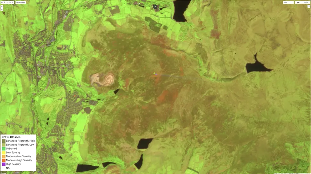
In 2018, the Saddleworth Moor wildfire scorched over 2,400 hectares of land, with severe impacts on the delicate peatland ecosystem that underlies much of the moor. Peatlands, rich in carbon and biodiversity, are especially vulnerable to fires, which can penetrate deeply into the peat layers, causing long-lasting damage. In the case of Saddleworth, the intense heat from the fire not only destroyed surface vegetation but also ignited the peat itself, releasing significant amounts of stored carbon into the atmosphere, this was a double blow for climate resilience.
The damage to peatland is not only immediate but also long-term. When the protective vegetation layer burns away, the exposed peat is prone to erosion and further carbon loss. The Saddleworth fire highlighted the vital role of peatlands as carbon sinks and the need for ongoing restoration and management to protect these ecosystems from similar events in the future. The WorldPeatland project is leveraging Earth Observation (EO) data and methods to monitor peatlands in different biomes and different states, including fire-impacted areas like Saddleworth Moor, to track their recovery over time. By utilising satellite data and advanced remote sensing techniques, the project can detect changes in vegetation cover, moisture levels, and carbon content, which are critical indicators of peatland health. For Saddleworth Moor, EO data enables the
WorldPeatland team to assess the regrowth of native vegetation and the re-establishment of the carbon-rich soil layer—a key factor in determining recovery from the 2018 fire. Using EO, we’ve been able to monitor how this burned landscape is recovering – and what we found was eye-opening.
While optical data provided some insights, it wasn’t enough. Optical datasets alone revealed that vegetation cover had returned within two to three years post-fire. But what did this actually mean? By integrating Synthetic Aperture Radar (SAR) data, we could see a better picture: though grassy vegetation recovered relatively quickly, woody vegetation had not yet returned to its pre-fire levels. SAR data, sensitive to structural differences, showed that the woody plants needed for long-term ecological stability can take up to 10 years to fully regrow.
The contrast in these data sources underscores an important lesson: recovering vegetation cover doesn’t always mean an ecosystem is restored. Advanced Earth observation methods like SAR reveal critical structural data that optical sensors alone can miss.
With increasingly frequent fires, having a comprehensive monitoring on post-fire recovery – beyond just green coverage – is essential for sustainable ecosystem management and climate resilience. This monitoring is essential for understanding the resilience of these unique ecosystems and for guiding restoration efforts. Through partnerships with organizations and policymakers, the WorldPeatland Project is helping to secure the long-term health of peatlands and mitigate climate risks associated with their degradation.
Video
This short animation shows pre and post fire false composite as well as a dNBR image. The pre-fire picture is false colour image based on Sentinel-2 in May 2018, the post fire corresponds to June 2018. The dNBR (Differenced Normalized Burn Ratio) is a simple ratio used to assess the severity of fire burnt areas.


